- Posted by :GUA·QUYE
- Date :21 Aug, 2024
- Category : Agroforestry
At GUA·QUYE Agroforestal we embrace Open Science and are constantly creating helpful guidelines and videos so you can take advantage of these tools! These guidelines are available in two, English and Spanish, so we can reach a bigger audience worldwide.
These are some of the examples we offer so you can star to apply them to your projects, especially those oriented to agroforestry, but their options are wider. The idea is that you explore them as you wish and here you have just a starting point:
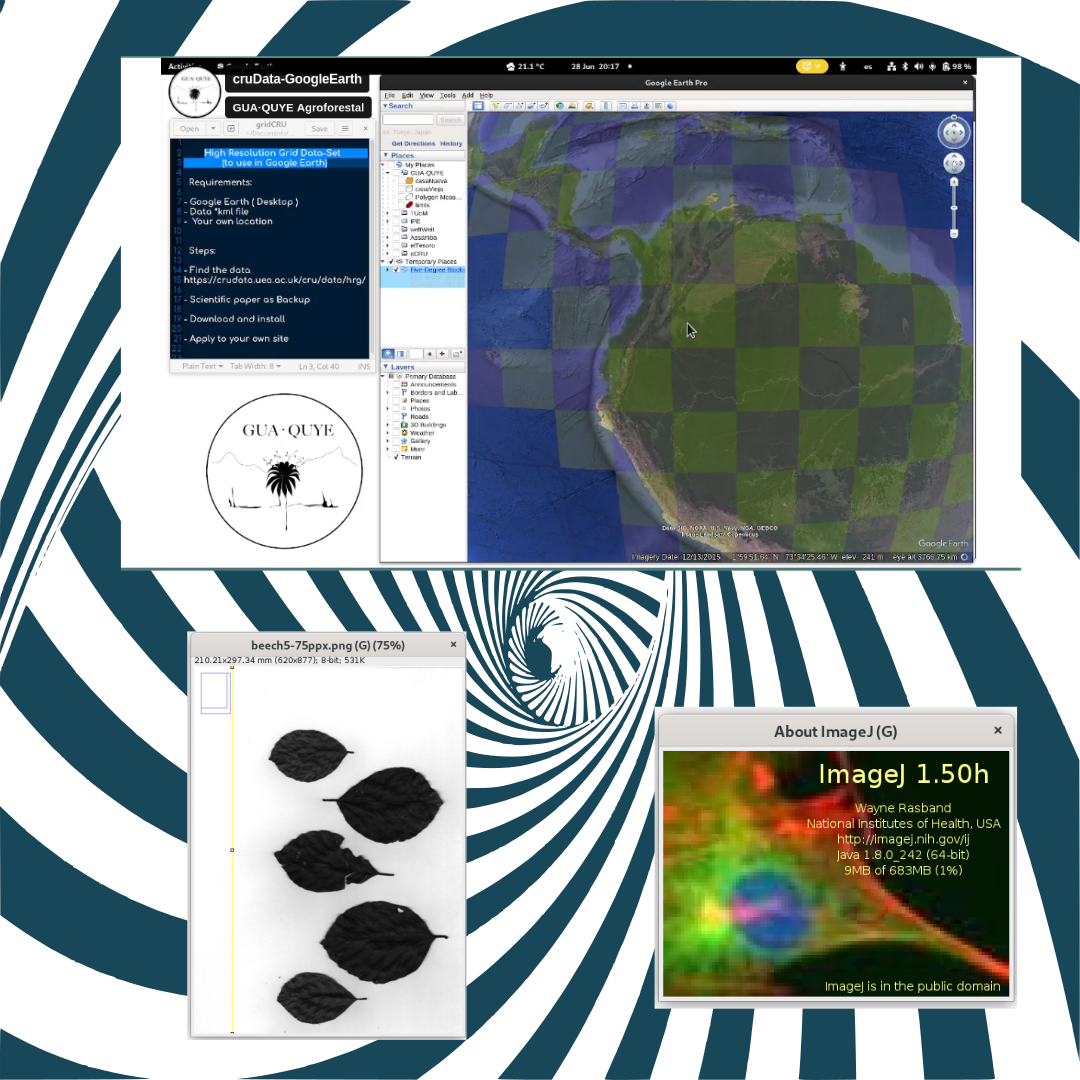
CRU-TS Dataset
The Climatic Research Unit GRIDDED Time Series (CRU-TS ) dataset is a widely used climate dataset on a 0.5° latitude by 0.5° longitude grid over all land domains of the world except Antarctica. It is derived by the interpolation of monthly climate anomalies from extensive networks of weather station observations. Check down in our suggested references for the full article explaining the CRU Data Set.
You can also watch our 5 minutes video-tutorial about using the
Leaf area measurement
This guide was created to refine some of the knowledge about some characteristics of different plants. Knowledge sometimes not easy available for specific species.
The guide
In the case of Agroforestry systems, this information is useful to understand, for example, the shadowing effects and tree cover applied on a specific area and a particular crop.
More guides and video-tutorials will be available soon!
Suggested References:
1- Video-tutorial CRU-TS Climate Data & GoogleEarth
4- Association for Temperate Agroforestry
5- Center for Research in Sustainable Agricultural Production Systems–CIPAV
8- Red científica Agroforestal de Latinoamérica
9- Center for International Forestry Research and World Agroforestry (CIFOR-ICRAF)